| The final boundary
determination will be made by LAFCO in the spring of 2002, following further
analysis, input and refinement of precise boundaries. A summary description
of modules is provided below.
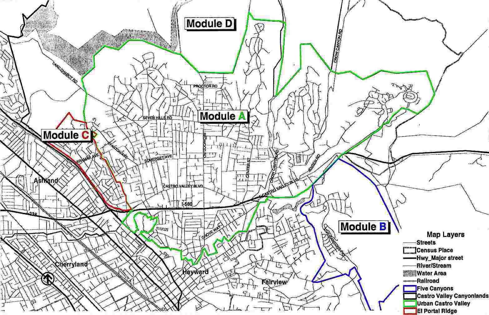
Module A. This module includes primarily the Castro Valley urban area and is bordered by the El Portal ridge (generally along the properties on Crest and Rolando Avenues) to the west, and generally along the area dividing Villareal Drive and Sunnyslope Avenue, including a portion of Eden Canyon Road to the east. The Castro Valley canyonlands and rural areas, including the East Bay Regional Park land, create the boundary to the north, and the city limits of Hayward to the south (Population: 50,000). Module B. This module, also known as the Five Canyons area, is bordered by the canyon and Fairview Avenue to the west, the back of the properties along the west side of Palomares Road to the east, Interstate 580 to the north, and generally along the jeep trail and property lines to the south (Population: 2,565). Module C. This module, also known as the El Portal Ridge area, is bordered by Foothill Boulevard to the west, the ridge (generally along the properties on Crest and Rolando Avenues) to the east, the Fairmont property line to the north, and Foothill Boulevard to the south (Population: 5,700). Module D.* This module, also known as the Castro Valley canyonlands and rural areas, is bordered by the city limits of Oakland and San Leandro and the unincorporated area known as Hillcrest Knolls and Foothill Boulevard to the west, the township line and the city limits of Dublin to the east, the county boundary to the north, and generally Castro Valley urban area to the south (Population: 500). (From EPS web page) *Module D was excluded from the study by LAFCO |
![]()
![]()
![]()
![]()
![]()
![]()
![]()
![]()
![]()